Parking on the road, near the Travellers Rest pub, this walk starts with a good flat half mile walk along roads and lanes. Once you hit the mile barrier the route becomes rocky and steep, 400m climb in just over 1.5 miles. However climbing is quite easy as it just like walking up steps, lots and lots of steps… Once past the steps the terrain smooths out and fell walking begins, it’s still a steep climb but softer on the feet and knees. The higher you climb to more it brings Grassmere in to view with its distinctive island.

Lots and lots of steps…

Grasmere
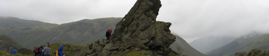
With the summit in sight the scale of Helm Crag becomes evident. To reach the proper summit requires and bit of grappling and climbing. The picture make the summit look easier than it really is. Several attempts were unsuccessfully met by sliding back down the smooth rock and as I was only 5 months post prolapsed disk operation I gave up 🙁 I will conqueror Helm Crag one day though…

Helm Crag
Passing over Braken Hause there is a great view to Grassmere Common before the steep route down. The gradient is about 45° on grass so as much as it’s soft on the knees your footing needs to be watched as slipping is easily done. Once back on the flat the last mile or so is a good place to cool down while heading back to the car.

Grassmere Common

The steep descent
Start point: Park on A591
Start OS Ref: NY335089
Map: OL7 The Lake District: SE
Length: 3.6 mile (5.8km)
Height: 405m
Est time: 2hrs 10mins
Difficulty: Medium
Current Weather: Ambleside
Memory Map Route: MMO File
GPS Data: GPX File
(Right click ‘GPX File’ and click ‘save as’.)