We parked in the Ramblers Inn car park, just past the train station, but asked permission from the landlord and explained we’d be back for a meal after the walk. There is a visitors centre further along the road but I don’t know how much parking costs there. The start of the walk, for us, was past the Visitors Centre, through Edale village past the Old Nags Head and right at the sign post to Kinder Scout. This took us across a footbridge, to a well laid path, on the route to Grinds Brook.

The Old Nags Head

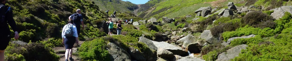
Path to Grinds Brook
The route up Grinds Brook is quite tricky but great fun. Your actually walking up the river bed and crossing it several times. There are small waterfalls to climb, rocks to traverse and the odd pathway. When we walked, the brook was low but I can imagine its quite hard to walk up after serious rainfall. Footing needs to be watched esp. when crossing the brook and climbing the rock faces as we found them slippy in places.

Grinds Brook

Waterfall
Once at the top of Grinds Brook a look back reveals how high you really are. The walk from here to Kinder Scout is not easy, if your not an experienced walker and it’s wet then it’s best to turn back. The peaty surface will make walking very difficult when wet.

Top of Grinds Brook
The path to Kinder Scout is not easy to follow and we went a little off track but were never really lost, a good bit of compass work and map reading kept us going in the right direction. The open top is very difficult to navigate across as there are no real reference points to walk to, so a map and compass are essential. Also there are streams running all through the peat surface, which in wetter times will be immensely boggy, and these need to be jumped across.

Peat bogs

Streams in the peat
Head towards Kinder Downfall by walking in the base of the stream, if it’s not too full after rainfall. I completed this walk after a dry spring and I can’t say how deep the water could be after heavy downfalls, so please take care. This makes for easy navigation and if you come to a T-junction then just follow the flow of water downhill to the waterfall. Once at the waterfall keep to the left and join the Pennine Way and carry on to Cluther Rocks.

River bed

Waterfall
Once past Cluther Rocks, heading towards Kinder Low, the landscape becomes almost Luna. With very little vegetation and rocks strewn all over the place this doesn’t resemble the usual grassy fells of the Peak District.

Kinder Low
On past Noe Stool and down to Edale Cross offers a nice view down to Jacob’s Ladder. Again, a well paved if uneven walkway, highlights the route down. This route is quite steep to the top of Jacob’s Ladder but this becomes even steeper once on the Ladder its self. There are 2 routes down from here, Jacob’s Ladder to the left or a bypass to the right. We took the left option and this will really tested the strength of your leg muscles esp. towards the end of a long walk…

Path to Jacob’s Ladder

Jacob’s Ladder
While following the Pennine Way back to the road and the Visitors Centre there is one more climb, its not too high but after the previous 9 miles your legs will not thank you for it. Heading back to the Ramblers Inn my GPS clocked us at just over 10 miles, admittedly the slight detour on top of Kinder Scout added a few hundred meters, so you need to expect to walk further than the route planner tells you.
Start point: Visitors Centre, Edale Village
Start OS Ref: SK122859
Map: OL1 The Peak District: Dark Park
Length: 9.5miles (15km)
Height: 636m
Est time: 5hrs
Difficulty: Hard
Current Weather: Buxton
Memory Map Route: MMO File
GPS Data: GPX File
(Right click ‘GPX File’ and click ‘save as’.)